Trans Himalayan Tour (P) Ltd.
Over 50 years of Delivering Himalayan Adventures
MANASLU CIRCUIT TREK -17 DAYS
Trip facts
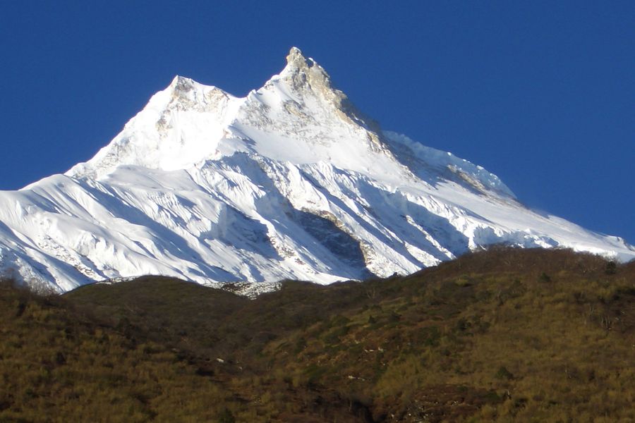
The Manaslu Circuit trek is considered to be one of the best treks in Nepal due to the range of scenery, the amalgam of Tibetan and Gurung cultures, and for the less crowded trails. It has not been long since Manaslu was opened for tourists in 1991. Trekking on the circuit around Mt. Manaslu (8163m), the world’s 8th highest mountain, provides exquisite mountain views as well as a sense of being one with nature. Mt. Manaslu was first summited by a Japanese expedition team in 1956 and it has always been a mountain that brings great pride as it was the first 8000m peak to be summited by the Japanese. The Manaslu circuit trek involves crossing the dramatic Larkya La Pass (5100m) and the trek is a bit more challenging because of the longer camp sites and steep climbs.
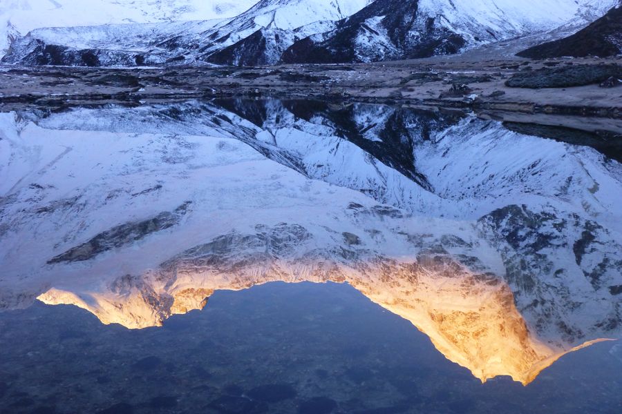
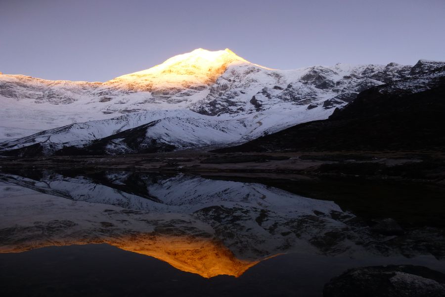
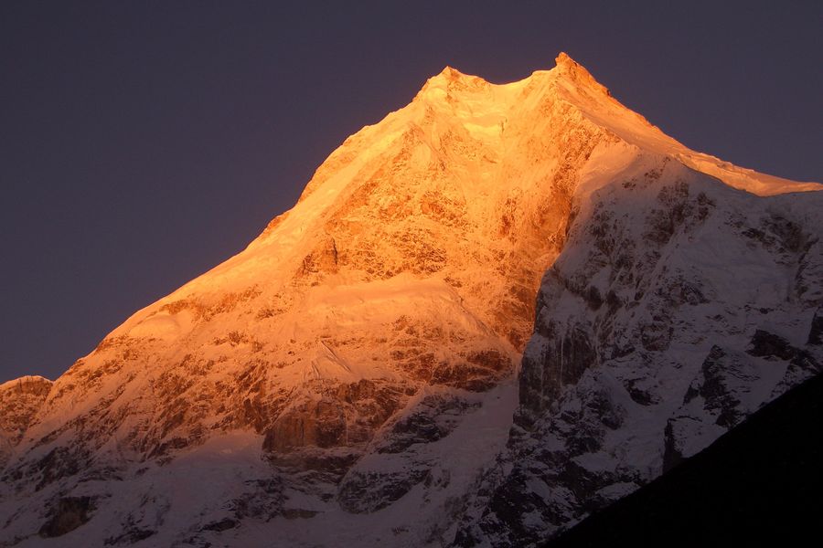
This is a restricted area and its residents include Tibetan immigrants who settled into the Nupri region in the 1600s as well as Gurung settlements in the lower altitudes. Many avid mountain photographers consider the rising sun beaming on the top of the beautiful Mt. Manaslu as one of the best sunrise pictures of the Himalayas. The circuit takes you on a journey from the warmer rice and millet farmlands through the huge gorges of the mighty Budhi Gandaki river, through stunning waterfalls, turquoise glacier lakes, long suspension bridges and crossing a high pass near the Nepal – Tibet border .
BRIEF DETAILS
DAY 01:
International Arrival in Kathmandu
DAY 02:
Drive from Kathmandu to Soti Khola: 8-9 hrs. Ending Elevation: 700m
DAY 03:
Soti Khola to Machha Khola: 6-7 hrs. Ending Elevation: 869m
DAY 04:
Machha Khola to Jagat: 6-7 hrs. Ending Elevation: 1340m
DAY 05:
Jagat to Deng: 6-7 hrs. Ending Elevation: 1860m
DAY 06:
Deng to Namrung: 6-7 hrs. Ending Elevation: 2630m
DAY 07:
Namrung to Lho: 4 hrs. Ending Elevation: 3180m
DAY 08:
Lho to Samagaon: 4 hrs. Ending Elevation: 3540m
DAY 09:
Acclimatization Day in Samagaon: Day trip to Pungyen Gompa, Manaslu Basecamp or Birendra Tal
DAY 10:
Samagaon to Samdo: 4 hrs. Ending Elevation: 3875m
DAY 11:
Acclimatization Day in Samdo
DAY 12:
Samdo to Dharamsala: 4-5 hrs. Ending Elevation: 4460m
DAY 13:
Dharamsala to Bimthang via Larkya La Pass (5160m): 8-9 hrs. Ending Elevation: 3590m
DAY 14:
Bimtang to Tilije: 5-6 hrs. Ending Elevation: 2300m
DAY 15:
Tilije to Dharapani: 3-4 hrs. Jeep drive from Dharapani to Besi Sahar: 3-4 hrs. Ending Elevation: 760m
DAY 16:
Drive from Besi Sahar to Kathmandu: 6-7 hours. Ending Elevation: 1440m
DAY 17:
International Departure
INCLUDED IN COST
 International & domestic airport pick up and drop off to and from a hotel in Kathmandu
 Overnights in Kathmandu on BB (bed & breakfast) basis in a 4/5 star category hotel
 Domestic flights and ground transportation
 Government licensed main trekking guide, assistant guide (for groups over 3 pax) and porters. One porter for every two trekkers.
 Staff costs are included – wages, insurance, equipment, food & accommodation
 Trekking accommodation in tea houses with attached bathrooms where available
 3 meals a day including breakfast, lunch, and dinner plus tea/coffee breaks during the trek
 A 60 liter company duffel bag per person – for yours to keep
 Sleeping bags (good up to -20 degrees) and hot water bags for the duration of the trek
 First Aid kit – to be carried by the trekking guide
 Trekking permits and entrance fees
 Kathmandu valley sight-seeing tour with private vehicle and city guide as mentioned in itinerary
 All rates are inclusive of service charge and government tax
DAY 01:
International Arrival in Kathmandu
DAY 02:
Drive from Kathmandu to Soti Khola: 8-9 hrs. Ending Elevation: 700m
DAY 03:
Soti Khola to Machha Khola: 6-7 hrs. Ending Elevation: 869m
DAY 04:
Machha Khola to Jagat: 6-7 hrs. Ending Elevation: 1340m
DAY 05:
Jagat to Deng: 6-7 hrs. Ending Elevation: 1860m
DAY 06:
Deng to Namrung: 6-7 hrs. Ending Elevation: 2630m
DAY 07:
Namrung to Lho: 4 hrs. Ending Elevation: 3180m
DAY 08:
Lho to Samagaon: 4 hrs. Ending Elevation: 3540m
DAY 09:
Acclimatization Day in Samagaon: Day trip to Pungyen Gompa, Manaslu Basecamp or Birendra Tal
DAY 10:
Samagaon to Samdo: 4 hrs. Ending Elevation: 3875m
DAY 11:
Acclimatization Day in Samdo
DAY 12:
Samdo to Dharamsala: 4-5 hrs. Ending Elevation: 4460m
DAY 13:
Dharamsala to Bimthang via Larkya La Pass (5160m): 8-9 hrs. Ending Elevation: 3590m
DAY 14:
Bimtang to Tilije: 5-6 hrs. Ending Elevation: 2300m
DAY 15:
Tilije to Dharapani: 3-4 hrs. Jeep drive from Dharapani to Besi Sahar: 3-4 hrs. Ending Elevation: 760m
DAY 16:
Drive from Besi Sahar to Kathmandu: 6-7 hours. Ending Elevation: 1440m
DAY 17:
International Departure
Day 1 | International arrival in Tribhuvan Airport, Kathmandu
Welcome to Nepal! A representative from Trans Himalayan Tour will pick you up from the airport and take you to your hotel in Kathmandu. Overnight in Kathmandu.
Day 2 | Drive from Kathmandu to Soti Khola: 8-9 hrs. Ending Elevation: 700m
Today we will take a jeep ride from Kathmandu to Soti Khola, driving along the Kathmandu – Pokhara highway. From the town of Dhading, the road will become rougher and bumpier. You will be rewarded with views of lush hillsides, small towns and get a glimpse of everyday lives of Nepalis as they go about their day. It is a long drive to Soti Khola but you will reach there in time for dinner.
Day 3| Soti Khola to Machha Khola: 6-7 hrs. Ending Elevation: 869m
On our first day of trekking, we will trek along the Budhi Gandaki river on some rocky and narrow trails going uphill and downhill. A large portion of the trail is blasted out of vertical rock walls. This combined with crossing long suspension bridges and walking above the raging rapids makes for an exciting first day of trekking. We will pass through some landslide areas, towering cliffs, waterfalls and walk along traditional Gurung settlements. The beautiful countryside will more than make up for the winding trails. We will stop at Machha Khola for the night.
Day 4 | Machha Khola to Jagat: 6-7 hrs. Ending Elevation: 1340m
Today’s trek will follow the river banks and traverse through the deep gorges of the Budhi Gandaki. Going up and down the trail, you will reach Tatopani, which is a hot springs area and a great place to take a break. After crossing the suspension bridge over Budhi Gandaki, you will start climbing up the stone steps and pass through the villages of Doban, drop to the river and climb up again to the village of Thado Bharyang. Langur monkeys are frequently sited on the trails as they freely roam around the trees. Once you reach the top of the ridge, the river valley widens and the trail descends to Jagat. Jagat is a well maintained Gurung village that has a beautiful square with lodges, shops, a police post and an ACAP (Annapurna Conversation Area Project) office where your restricted area permits will be checked.
Day 5 | Jagat to Deng: 6-7 hrs. Ending Elevation: 1860m
The trail begins by traversing through a rocky ridge to Salleri and then descends to Sirdibas. As the valley widens, you will continue to walk upstream to Philim, a large Gurung settlement. From here, it is a fairly level trail for about one hour to Ekle Bhatti, passing through corn and millet fields. Take some time to admire the waterfalls along the way which are located on the west side of the valley. The route then enters a steep, uninhabited gorge dotted with pine trees. After walking down through the grassy slopes, cross the Budhi Gandaki river and walk along the riverbanks. We then trek through rhododendron and pine forests and enter the small village of Deng. We are now well inside the Manaslu restricted area.
Day 6 | Deng to Namrung: 6-7 hrs. Ending Elevation: 2630m
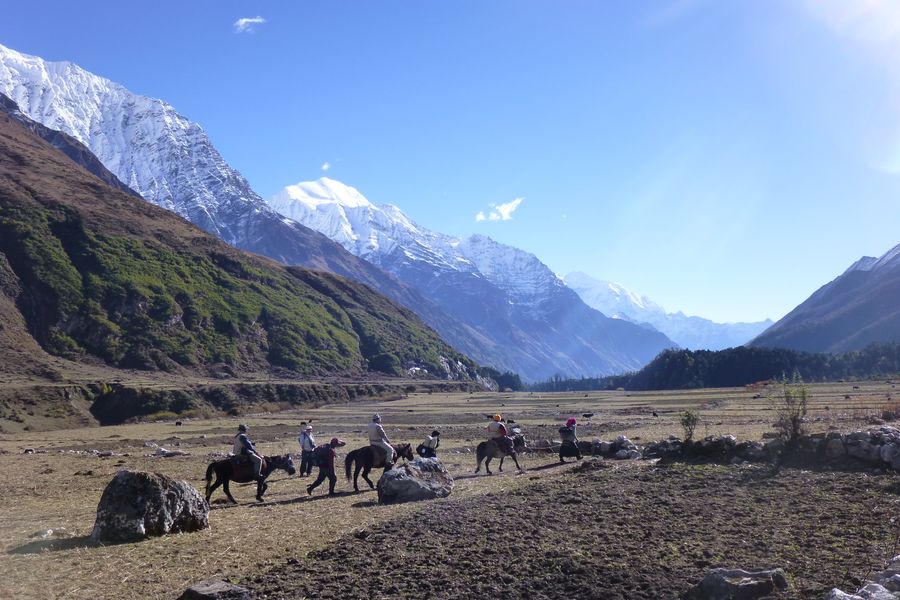
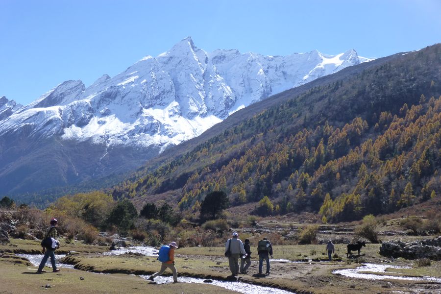
After breakfast at Deng, you will cross the Budhi Gandaki river several times and head westwards up the valley, passing through lush green forests of fir and rhododendrons alive with birds and grey langur monkeys. You will also pass a few Buddhist gompas and the well carved mani walls in Ghap depicting Buddha in various meditative poses. The architecture changes to Tibetan influence with dry stone structures, mani walls, chortens and kani. You may also encounter locals working in the fields to grow buckwheat, barley and maize. After a steep climb to Namrung where you will be rewarded with views of the ice capped mountains in the horizon, you can enjoy the well-equipped lodges for the night.
Day 7 | Namrung to Lho: 4 hrs. Ending Elevation: 3180m
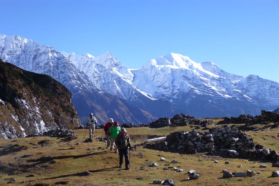
Today is an easier day with gentler trails with gradual uphill and shorter trekking time. After Namrung, the trail enters upper Nupri region with heavy Tibetan influences. The locals here practice Tibetan Buddhism and they originally migrated from Tibet. You may find locals clad in chubas (Tibetan outfit) and their economies are based on agriculture and trade. After the village of Sho, the spectacular peaks of Manaslu, Manaslu North and Naike Peak dominate the skyline. At Lho, you can explore the Ribang Gompa, the mani walls, chortens and the kani (gate arches) painted in beautiful Buddhist motives.
Day 8 | Lho to Samagaon: 4 hrs. Ending Elevation: 3540m
Walking along the trail with a picturesque view of Mt. Manaslu straight ahead, Himal Chuli and Peak 29 to the left, we will head towards Sama Gaon where we will be spending two nights. We hike across forests, streams and valley and the view just keeps on getting more and more spectacular. It is another short trekking day due to the gain in altitude. Sama Gaon is the main village in the Nubri valley and houses a big gompa, several shops, pastures for horses and yaks, and fields of wheat and buckwheat, a health post and a helipad. Acting as a base for day trips holding amazing viewpoints only adds value to the village of Samagaon.
Day 9 | Acclimatization Day in Samagaon:
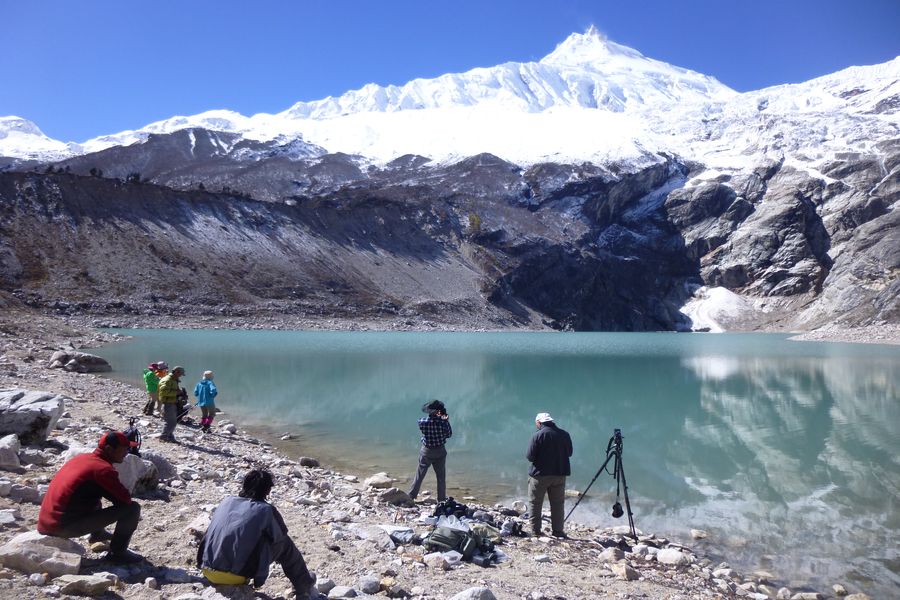
Day trip to Pungyen Gompa, Manaslu Basecamp or Birendra Tal Samagaon is a perfect spot for an acclimatization day as it holds not just one but three amazing day trips that you can choose from. The easiest one would be to do a round trip to Birendra Tal (3450m, 2 hours of leisurely walk), the trip to Pungyen Gompa is a more moderate hike which holds terrific views of the east face of Manaslu (4100m, 4-5 hours round trip) or you can take a more challenging hike to Manaslu Base Camp (4800m, 5-6 hours round trip) to behold the panoramic views of Mt. Manaslu, Ganesh Himal, Shrigni and Himal Chuli. For the longer hikes it is best to take a packed lunch and you may also spot some blue sheep and yaks grazing on the hills. If you really want a challenging day, is possible to combine all three day trips by visiting Pungyen Gompa which is located to the south of Samagaon, hiking further to Birendra Tal (a glacial lake) and take a steep climb onto Manaslu Base Camp and descend back to Samagaon.
Day 10 | Samagaon to Samdo: 4 hrs. Ending Elevation: 3875m
Today is a relatively short trek but it is important that you walk slowly as you are gaining more altitude. It is a beautiful walk today with Manaslu’s north eastern face in full view, following a trail above the river, past juniper and birch forests and stone huts. Samdo is a picturesque village with extended yak pastures, long mani walls and with the Samdo Peak right behind the village. You are close to the Tibet border and the people of Samdo were originally from the trading village of Ru in Tibet and had fled to Nepal after the Chinese occupation in the early 1960s. In the afternoon you can take a hike to Samdo Peak for a magnificent view of the Manaslu range.
Day 11 | Acclimatization Day in Samdo
We will have another acclimatization day in Samdo. This will help your body get ready for the Larkya La Pass and you can also take the time to fully enjoy being in the Nepal Himalayas. The northern slopes of Samdo have wonderful views of the entire Manaslu range and there are two options for the day trips. The first option (recommended) is to hike up the valley behind Samdo for excellent views of Mt. Manaslu, Simrang, Hiuchuli, Ngadi, Larkye Peak and Kang Guru. You may also encounter Nepal’s national bird called the Danphe (Impheyan pheasant) and Himalayan griffins soaring high above the clouds. The second option is to go on the original trading route to Tibet north of Samdo towards Gya La, although this is a more challenging hike. You will be hiking near the Tibetan border and should be able to see parts of Tibet and Nepal.
Day 12 | Samdo to Dharamsala: 4-5 hrs. Ending Elevation: 4460m
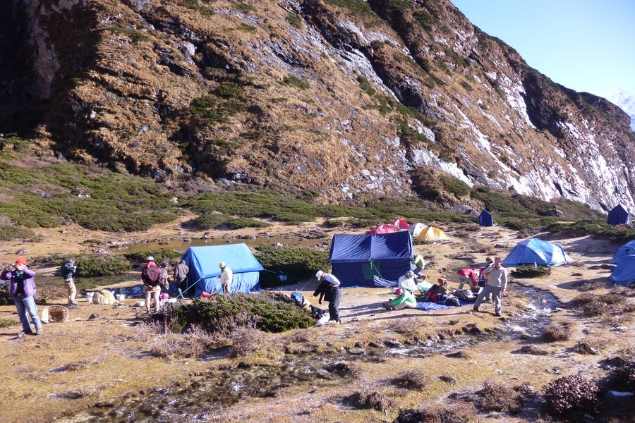
The day will start by descending on a wide and gentle trail from Samdo, past the fields and on to sparser vegetation as the altitude goes higher. The trail climbs through large piles of mani stones with a view of Larkye Peak and the north face of Manaslu. You will also have a magnificent view of the Syachu glacier along the rugged terrain. The lodging at Dharamsala is very basic, make sure to go to bed early for an early start the next morning.
Day 13 | Dharamsala to Bimthang via Larkya La Pass (5160m): 8-9 hrs. Ending Elevation: 3590m
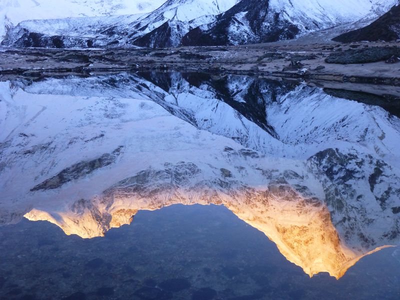
Today is the most challenging as well as the most rewarding day of the trek. It will be cold and windy so make sure that you are dressed appropriately. We will start our day before sunrise and ascend towards Larka La Pass. The trail is a rock-strewn path on snow and ice and the views are incredible from the time you start to see the sun rays hitting the peaks. You will pass through glacier lakes, walk on the glacier moraine and after a steep climb to reach the top of Lakya La Pass at 5160m, you will be rewarded with outstanding views of Himlung Himal, Cheo Himal, Annapurna II Gyaji Kung and Kang Guru amongst the other Himalayas. After taking the time to soak in the scenery and the sense of achievement, you will start to make your way down the steep switchback trail to Bimthang. The valley becomes wider and the trail starts to get easier before you reach the village.
Day 14 | Bimthang to Tilije: 5-6 hrs. Ending Elevation: 2300m
Bimthang is renowned for having some of the best landscape views in the Manaslu circuit trek. Its idyllic location in the middle of the valley surrounded by towering peaks makes it easy to understand why. From a nearby ridge, you can see the towering views of Manaslu, Lamjung Himal, Himlung Himal and Cheo Himal. As we trek down in altitude, the lush vegetation starts to replace the alpine shrubs and the trail is an easy gradient of downhill until the village of Gho. After crossing the Dudh Khola, we pass through rhododendron forests, farmed fields and scattered settlements. It is a wonderful hike with views of the Himalayas, lush green forests and the glacier streams flowing below. Although there are lodges in Gho, we recommend the Gurung village of Tilije which have nicer accommodations.
Day 15 | Tilije to Dharapani: 3-4 hrs. Jeep drive from Dharapani to Besi Sahar: 3-4 hrs. Ending Elevation: 760m
Trekking along the riverbank, the path gradually descends towards the Marsyangdi Valley and merges with the Annapurna Circuit route to Dharapani. After crossing your last suspension bridge for the Manaslu Circuit trek, you will reach Dharapani for lunch and then make your way to Besi Sahar via jeep. The jeep drive is around 3-4 hours, passing through waterfalls and lush vegetation. Enjoy the final day of the trek.
Day 16 | Drive from Besi Sahar to Kathmandu: 6-7 hours. Ending Elevation: 1440m
After breakfast in Besi Sahar, we will begin our journey back to Kathmandu on a privately hired jeep. It is a scenic (and some parts bumpy) drive through the hill highway with wonderful views of midland Nepal. Trisuli River and the green hills make for a pleasant view from your window seat and we will stop for lunch along the way. We will drop you at your hotel in Kathmandu where you can enjoy the nice amenities and a variety of cuisines.
Day 17 | International Departure
As this epic adventure wraps up, you may already be planning for your next trip to Nepal. A representative from Trans Himalayan Tour will escort you to the international airport in Kathmandu and we wish you a pleasant flight home. All the best until we meet again!
Include:
 International & domestic airport pick up and drop off to and from a hotel in Kathmandu
 Overnights in Kathmandu on BB (bed & breakfast) basis in a 4/5 star category hotel
 Domestic flights and ground transportation
 Government licensed main trekking guide, assistant guide (for groups over 3 pax) and porters. One porter for every two trekkers.
 Staff costs are included – wages, insurance, equipment, food & accommodation
 Trekking accommodation in tea houses with attached bathrooms where available
 3 meals a day including breakfast, lunch, and dinner plus tea/coffee breaks during the trek
 A 60 liter company duffel bag per person – for yours to keep
 Sleeping bags (good up to -20 degrees) and hot water bags for the duration of the trek
 First Aid kit – to be carried by the trekking guide
 Trekking permits and entrance fees
 Kathmandu valley sight-seeing tour with private vehicle and city guide as mentioned in itinerary
 All rates are inclusive of service charge and government tax
Exclude:
 International flight tickets
 Lunch & dinner outside of trekking (not included in Kathmandu/other cities)
 Nepal entry visa fee – visa is available upon arrival at Tribhuvan International Airport in Kathmandu
 Medical insurance – please make sure you have travel insurance for Nepal
 Alcoholic beverages/soft drinks/bottled water
 Tips (tipping is expected)
Trip facts
The Manaslu Circuit trek is considered to be one of the best treks in Nepal due to the range of scenery, the amalgam of Tibetan and Gurung cultures, and for the less crowded trails. It has not been long since Manaslu was opened for tourists in 1991. Trekking on the circuit around Mt. Manaslu (8163m), the world’s 8th highest mountain, provides exquisite mountain views as well as a sense of being one with nature. Mt. Manaslu was first summited by a Japanese expedition team in 1956 and it has always been a mountain that brings great pride as it was the first 8000m peak to be summited by the Japanese. The Manaslu circuit trek involves crossing the dramatic Larkya La Pass (5100m) and the trek is a bit more challenging because of the longer camp sites and steep climbs.
This is a restricted area and its residents include Tibetan immigrants who settled into the Nupri region in the 1600s as well as Gurung settlements in the lower altitudes. Many avid mountain photographers consider the rising sun beaming on the top of the beautiful Mt. Manaslu as one of the best sunrise pictures of the Himalayas. The circuit takes you on a journey from the warmer rice and millet farmlands through the huge gorges of the mighty Budhi Gandaki river, through stunning waterfalls, turquoise glacier lakes, long suspension bridges and crossing a high pass near the Nepal – Tibet border .
BRIEF DETAILS
DAY 01:
International Arrival in Kathmandu
DAY 02:
Drive from Kathmandu to Soti Khola: 8-9 hrs. Ending Elevation: 700m
DAY 03:
Soti Khola to Machha Khola: 6-7 hrs. Ending Elevation: 869m
DAY 04:
Machha Khola to Jagat: 6-7 hrs. Ending Elevation: 1340m
DAY 05:
Jagat to Deng: 6-7 hrs. Ending Elevation: 1860m
DAY 06:
Deng to Namrung: 6-7 hrs. Ending Elevation: 2630m
DAY 07:
Namrung to Lho: 4 hrs. Ending Elevation: 3180m
DAY 08:
Lho to Samagaon: 4 hrs. Ending Elevation: 3540m
DAY 09:
Acclimatization Day in Samagaon: Day trip to Pungyen Gompa, Manaslu Basecamp or Birendra Tal
DAY 10:
Samagaon to Samdo: 4 hrs. Ending Elevation: 3875m
DAY 11:
Acclimatization Day in Samdo
DAY 12:
Samdo to Dharamsala: 4-5 hrs. Ending Elevation: 4460m
DAY 13:
Dharamsala to Bimthang via Larkya La Pass (5160m): 8-9 hrs. Ending Elevation: 3590m
DAY 14:
Bimtang to Tilije: 5-6 hrs. Ending Elevation: 2300m
DAY 15:
Tilije to Dharapani: 3-4 hrs. Jeep drive from Dharapani to Besi Sahar: 3-4 hrs. Ending Elevation: 760m
DAY 16:
Drive from Besi Sahar to Kathmandu: 6-7 hours. Ending Elevation: 1440m
DAY 17:
International Departure
INCLUDED IN COST
 International & domestic airport pick up and drop off to and from a hotel in Kathmandu
 Overnights in Kathmandu on BB (bed & breakfast) basis in a 4/5 star category hotel
 Domestic flights and ground transportation
 Government licensed main trekking guide, assistant guide (for groups over 3 pax) and porters. One porter for every two trekkers.
 Staff costs are included – wages, insurance, equipment, food & accommodation
 Trekking accommodation in tea houses with attached bathrooms where available
 3 meals a day including breakfast, lunch, and dinner plus tea/coffee breaks during the trek
 A 60 liter company duffel bag per person – for yours to keep
 Sleeping bags (good up to -20 degrees) and hot water bags for the duration of the trek
 First Aid kit – to be carried by the trekking guide
 Trekking permits and entrance fees
 Kathmandu valley sight-seeing tour with private vehicle and city guide as mentioned in itinerary
 All rates are inclusive of service charge and government tax
DAY 01:
International Arrival in Kathmandu
DAY 02:
Drive from Kathmandu to Soti Khola: 8-9 hrs. Ending Elevation: 700m
DAY 03:
Soti Khola to Machha Khola: 6-7 hrs. Ending Elevation: 869m
DAY 04:
Machha Khola to Jagat: 6-7 hrs. Ending Elevation: 1340m
DAY 05:
Jagat to Deng: 6-7 hrs. Ending Elevation: 1860m
DAY 06:
Deng to Namrung: 6-7 hrs. Ending Elevation: 2630m
DAY 07:
Namrung to Lho: 4 hrs. Ending Elevation: 3180m
DAY 08:
Lho to Samagaon: 4 hrs. Ending Elevation: 3540m
DAY 09:
Acclimatization Day in Samagaon: Day trip to Pungyen Gompa, Manaslu Basecamp or Birendra Tal
DAY 10:
Samagaon to Samdo: 4 hrs. Ending Elevation: 3875m
DAY 11:
Acclimatization Day in Samdo
DAY 12:
Samdo to Dharamsala: 4-5 hrs. Ending Elevation: 4460m
DAY 13:
Dharamsala to Bimthang via Larkya La Pass (5160m): 8-9 hrs. Ending Elevation: 3590m
DAY 14:
Bimtang to Tilije: 5-6 hrs. Ending Elevation: 2300m
DAY 15:
Tilije to Dharapani: 3-4 hrs. Jeep drive from Dharapani to Besi Sahar: 3-4 hrs. Ending Elevation: 760m
DAY 16:
Drive from Besi Sahar to Kathmandu: 6-7 hours. Ending Elevation: 1440m
DAY 17:
International Departure
Day 1 | International arrival in Tribhuvan Airport, Kathmandu
Welcome to Nepal! A representative from Trans Himalayan Tour will pick you up from the airport and take you to your hotel in Kathmandu. Overnight in Kathmandu.
Day 2 | Drive from Kathmandu to Soti Khola: 8-9 hrs. Ending Elevation: 700m
Today we will take a jeep ride from Kathmandu to Soti Khola, driving along the Kathmandu – Pokhara highway. From the town of Dhading, the road will become rougher and bumpier. You will be rewarded with views of lush hillsides, small towns and get a glimpse of everyday lives of Nepalis as they go about their day. It is a long drive to Soti Khola but you will reach there in time for dinner.
Day 3| Soti Khola to Machha Khola: 6-7 hrs. Ending Elevation: 869m
On our first day of trekking, we will trek along the Budhi Gandaki river on some rocky and narrow trails going uphill and downhill. A large portion of the trail is blasted out of vertical rock walls. This combined with crossing long suspension bridges and walking above the raging rapids makes for an exciting first day of trekking. We will pass through some landslide areas, towering cliffs, waterfalls and walk along traditional Gurung settlements. The beautiful countryside will more than make up for the winding trails. We will stop at Machha Khola for the night.
Day 4 | Machha Khola to Jagat: 6-7 hrs. Ending Elevation: 1340m
Today’s trek will follow the river banks and traverse through the deep gorges of the Budhi Gandaki. Going up and down the trail, you will reach Tatopani, which is a hot springs area and a great place to take a break. After crossing the suspension bridge over Budhi Gandaki, you will start climbing up the stone steps and pass through the villages of Doban, drop to the river and climb up again to the village of Thado Bharyang. Langur monkeys are frequently sited on the trails as they freely roam around the trees. Once you reach the top of the ridge, the river valley widens and the trail descends to Jagat. Jagat is a well maintained Gurung village that has a beautiful square with lodges, shops, a police post and an ACAP (Annapurna Conversation Area Project) office where your restricted area permits will be checked.
Day 5 | Jagat to Deng: 6-7 hrs. Ending Elevation: 1860m
The trail begins by traversing through a rocky ridge to Salleri and then descends to Sirdibas. As the valley widens, you will continue to walk upstream to Philim, a large Gurung settlement. From here, it is a fairly level trail for about one hour to Ekle Bhatti, passing through corn and millet fields. Take some time to admire the waterfalls along the way which are located on the west side of the valley. The route then enters a steep, uninhabited gorge dotted with pine trees. After walking down through the grassy slopes, cross the Budhi Gandaki river and walk along the riverbanks. We then trek through rhododendron and pine forests and enter the small village of Deng. We are now well inside the Manaslu restricted area.
Day 6 | Deng to Namrung: 6-7 hrs. Ending Elevation: 2630m
After breakfast at Deng, you will cross the Budhi Gandaki river several times and head westwards up the valley, passing through lush green forests of fir and rhododendrons alive with birds and grey langur monkeys. You will also pass a few Buddhist gompas and the well carved mani walls in Ghap depicting Buddha in various meditative poses. The architecture changes to Tibetan influence with dry stone structures, mani walls, chortens and kani. You may also encounter locals working in the fields to grow buckwheat, barley and maize. After a steep climb to Namrung where you will be rewarded with views of the ice capped mountains in the horizon, you can enjoy the well-equipped lodges for the night.
Day 7 | Namrung to Lho: 4 hrs. Ending Elevation: 3180m
Today is an easier day with gentler trails with gradual uphill and shorter trekking time. After Namrung, the trail enters upper Nupri region with heavy Tibetan influences. The locals here practice Tibetan Buddhism and they originally migrated from Tibet. You may find locals clad in chubas (Tibetan outfit) and their economies are based on agriculture and trade. After the village of Sho, the spectacular peaks of Manaslu, Manaslu North and Naike Peak dominate the skyline. At Lho, you can explore the Ribang Gompa, the mani walls, chortens and the kani (gate arches) painted in beautiful Buddhist motives.
Day 8 | Lho to Samagaon: 4 hrs. Ending Elevation: 3540m
Walking along the trail with a picturesque view of Mt. Manaslu straight ahead, Himal Chuli and Peak 29 to the left, we will head towards Sama Gaon where we will be spending two nights. We hike across forests, streams and valley and the view just keeps on getting more and more spectacular. It is another short trekking day due to the gain in altitude. Sama Gaon is the main village in the Nubri valley and houses a big gompa, several shops, pastures for horses and yaks, and fields of wheat and buckwheat, a health post and a helipad. Acting as a base for day trips holding amazing viewpoints only adds value to the village of Samagaon.
Day 9 | Acclimatization Day in Samagaon:
Day trip to Pungyen Gompa, Manaslu Basecamp or Birendra Tal Samagaon is a perfect spot for an acclimatization day as it holds not just one but three amazing day trips that you can choose from. The easiest one would be to do a round trip to Birendra Tal (3450m, 2 hours of leisurely walk), the trip to Pungyen Gompa is a more moderate hike which holds terrific views of the east face of Manaslu (4100m, 4-5 hours round trip) or you can take a more challenging hike to Manaslu Base Camp (4800m, 5-6 hours round trip) to behold the panoramic views of Mt. Manaslu, Ganesh Himal, Shrigni and Himal Chuli. For the longer hikes it is best to take a packed lunch and you may also spot some blue sheep and yaks grazing on the hills. If you really want a challenging day, is possible to combine all three day trips by visiting Pungyen Gompa which is located to the south of Samagaon, hiking further to Birendra Tal (a glacial lake) and take a steep climb onto Manaslu Base Camp and descend back to Samagaon.
Day 10 | Samagaon to Samdo: 4 hrs. Ending Elevation: 3875m
Today is a relatively short trek but it is important that you walk slowly as you are gaining more altitude. It is a beautiful walk today with Manaslu’s north eastern face in full view, following a trail above the river, past juniper and birch forests and stone huts. Samdo is a picturesque village with extended yak pastures, long mani walls and with the Samdo Peak right behind the village. You are close to the Tibet border and the people of Samdo were originally from the trading village of Ru in Tibet and had fled to Nepal after the Chinese occupation in the early 1960s. In the afternoon you can take a hike to Samdo Peak for a magnificent view of the Manaslu range.
Day 11 | Acclimatization Day in Samdo
We will have another acclimatization day in Samdo. This will help your body get ready for the Larkya La Pass and you can also take the time to fully enjoy being in the Nepal Himalayas. The northern slopes of Samdo have wonderful views of the entire Manaslu range and there are two options for the day trips. The first option (recommended) is to hike up the valley behind Samdo for excellent views of Mt. Manaslu, Simrang, Hiuchuli, Ngadi, Larkye Peak and Kang Guru. You may also encounter Nepal’s national bird called the Danphe (Impheyan pheasant) and Himalayan griffins soaring high above the clouds. The second option is to go on the original trading route to Tibet north of Samdo towards Gya La, although this is a more challenging hike. You will be hiking near the Tibetan border and should be able to see parts of Tibet and Nepal.
Day 12 | Samdo to Dharamsala: 4-5 hrs. Ending Elevation: 4460m
The day will start by descending on a wide and gentle trail from Samdo, past the fields and on to sparser vegetation as the altitude goes higher. The trail climbs through large piles of mani stones with a view of Larkye Peak and the north face of Manaslu. You will also have a magnificent view of the Syachu glacier along the rugged terrain. The lodging at Dharamsala is very basic, make sure to go to bed early for an early start the next morning.
Day 13 | Dharamsala to Bimthang via Larkya La Pass (5160m): 8-9 hrs. Ending Elevation: 3590m
Today is the most challenging as well as the most rewarding day of the trek. It will be cold and windy so make sure that you are dressed appropriately. We will start our day before sunrise and ascend towards Larka La Pass. The trail is a rock-strewn path on snow and ice and the views are incredible from the time you start to see the sun rays hitting the peaks. You will pass through glacier lakes, walk on the glacier moraine and after a steep climb to reach the top of Lakya La Pass at 5160m, you will be rewarded with outstanding views of Himlung Himal, Cheo Himal, Annapurna II Gyaji Kung and Kang Guru amongst the other Himalayas. After taking the time to soak in the scenery and the sense of achievement, you will start to make your way down the steep switchback trail to Bimthang. The valley becomes wider and the trail starts to get easier before you reach the village.
Day 14 | Bimthang to Tilije: 5-6 hrs. Ending Elevation: 2300m
Bimthang is renowned for having some of the best landscape views in the Manaslu circuit trek. Its idyllic location in the middle of the valley surrounded by towering peaks makes it easy to understand why. From a nearby ridge, you can see the towering views of Manaslu, Lamjung Himal, Himlung Himal and Cheo Himal. As we trek down in altitude, the lush vegetation starts to replace the alpine shrubs and the trail is an easy gradient of downhill until the village of Gho. After crossing the Dudh Khola, we pass through rhododendron forests, farmed fields and scattered settlements. It is a wonderful hike with views of the Himalayas, lush green forests and the glacier streams flowing below. Although there are lodges in Gho, we recommend the Gurung village of Tilije which have nicer accommodations.
Day 15 | Tilije to Dharapani: 3-4 hrs. Jeep drive from Dharapani to Besi Sahar: 3-4 hrs. Ending Elevation: 760m
Trekking along the riverbank, the path gradually descends towards the Marsyangdi Valley and merges with the Annapurna Circuit route to Dharapani. After crossing your last suspension bridge for the Manaslu Circuit trek, you will reach Dharapani for lunch and then make your way to Besi Sahar via jeep. The jeep drive is around 3-4 hours, passing through waterfalls and lush vegetation. Enjoy the final day of the trek.
Day 16 | Drive from Besi Sahar to Kathmandu: 6-7 hours. Ending Elevation: 1440m
After breakfast in Besi Sahar, we will begin our journey back to Kathmandu on a privately hired jeep. It is a scenic (and some parts bumpy) drive through the hill highway with wonderful views of midland Nepal. Trisuli River and the green hills make for a pleasant view from your window seat and we will stop for lunch along the way. We will drop you at your hotel in Kathmandu where you can enjoy the nice amenities and a variety of cuisines.
Day 17 | International Departure
As this epic adventure wraps up, you may already be planning for your next trip to Nepal. A representative from Trans Himalayan Tour will escort you to the international airport in Kathmandu and we wish you a pleasant flight home. All the best until we meet again!
Include:
 International & domestic airport pick up and drop off to and from a hotel in Kathmandu
 Overnights in Kathmandu on BB (bed & breakfast) basis in a 4/5 star category hotel
 Domestic flights and ground transportation
 Government licensed main trekking guide, assistant guide (for groups over 3 pax) and porters. One porter for every two trekkers.
 Staff costs are included – wages, insurance, equipment, food & accommodation
 Trekking accommodation in tea houses with attached bathrooms where available
 3 meals a day including breakfast, lunch, and dinner plus tea/coffee breaks during the trek
 A 60 liter company duffel bag per person – for yours to keep
 Sleeping bags (good up to -20 degrees) and hot water bags for the duration of the trek
 First Aid kit – to be carried by the trekking guide
 Trekking permits and entrance fees
 Kathmandu valley sight-seeing tour with private vehicle and city guide as mentioned in itinerary
 All rates are inclusive of service charge and government tax
Exclude:
 International flight tickets
 Lunch & dinner outside of trekking (not included in Kathmandu/other cities)
 Nepal entry visa fee – visa is available upon arrival at Tribhuvan International Airport in Kathmandu
 Medical insurance – please make sure you have travel insurance for Nepal
 Alcoholic beverages/soft drinks/bottled water
 Tips (tipping is expected)
